
| Bolton WtE | |
|---|---|
 | |
| Country | England |
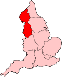
| Location | Greater Manchester, North West England |
| Coordinates | 53°33′58″N 2°24′33″W / 53.5661°N 2.4091°WCoordinates: 53°33′58″N 2°24′33″W / 53.5661°N 2.4091°W |
| Status | Operational |
| Commission date | 1971 |
| Operator(s) | Greater Manchester Waste |
| Thermal power station | |
| Primary fuel | Waste |
| Power generation | |
| Nameplate capacity |
|
|
grid reference SD730078 | |
The Bolton WtE is a waste power station constructed in 1971 in Bolton, and is a major landmark of its skyline. The incinerator burns up to 20 tonnes (22 tons) of household waste per hour or 85,000 t (94,000 tons) per year, and can generate up to 11 MW of electricity. The plant is operated by Suez Recycling and Recovery UK. The Bolton incinerator is the only household waste incinerator in Greater Manchester.
See also
External links
| Power stations |
|
 |
||||||||||||||||||||||||||||||||||||
|---|---|---|---|---|---|---|---|---|---|---|---|---|---|---|---|---|---|---|---|---|---|---|---|---|---|---|---|---|---|---|---|---|---|---|---|---|---|---|
| Organisations | ||||||||||||||||||||||||||||||||||||||